Every capture follows documented methodology. Every dataset is produced by a certified thermographer operating under a CASA-licensed structure. This is what makes the data usable - not just viewable.
IEC 62446-3 defines the conditions and methodology required for thermal drone capture of photovoltaic arrays to produce defensible, actionable data. We align every solar capture with this standard.
Why this matters: warranty claims, insurance requirements, and investor reporting all require documented evidence that capture was conducted to a recognised standard. IEC 62446-3 is what your manufacturer and insurer will ask for.
A thermal camera produces data. A certified thermographer produces findings. The difference determines whether your dataset identifies a genuine anomaly or flags a false positive that wastes maintenance resources.
Why this matters: most drone operators fly a thermal camera. Nick is trained to read what it captures. Ask any provider for their thermographer certification before engaging - it is the single most important qualification to verify.
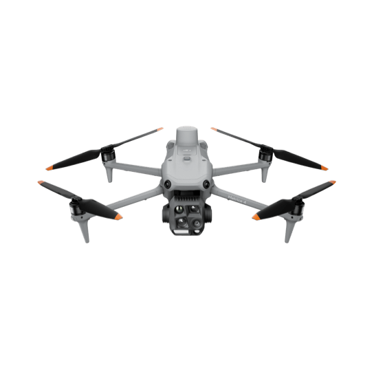
Radiometric sensor - every pixel contains a real temperature value, not a colour-mapped approximation. Required for anomaly classification and comparison across visits.
Centimetre-level positioning at point of capture via laser rangefinder. Every anomaly GPS-located to within a metre - your maintenance team navigates directly to it.
Temperature differentials detected at component level. Early-stage anomalies identified before they cause measurable output loss or appear in string-level monitoring data.
Every SkySpectra flight is conducted under a CASA-licensed structure. This matters to industrial and solar farm operators who need to demonstrate that any drone operator accessing their site was legally authorised to do so.
Required for any individual flying a drone commercially in Australia. Covers sub-25kg multi-rotor and fixed wing platforms. No RePL means no legal commercial flight - ask for it before any operator accesses your site.
Required for any business trading as a drone service provider for hire or reward. The business-level licence that underpins every commercial job. Held - certificate available on request.
Pilot credentials, drone registration, airspace authorisations, weather conditions, and flight parameters documented for every visit. Supports your regulatory audit trail and insurance requirements.
Commercial drone operations insurance covering public liability for industrial site work. Certificate of currency available on request prior to any site access.
Want the detail behind these standards?
See how we capture, process, and deliver every dataset - step by step.
Every program starts with understanding the asset - its size, access constraints, and what the client needs the data for. We design the capture around that, not around what is easiest to fly.
We have no maintenance contracts and no repair revenue. The data goes directly to you, for you to use in your own maintenance, insurance, and reporting decisions. That independence is deliberate - it is the only way to guarantee the findings serve the asset owner.
Asset owners who need structured, repeatable aerial data and cannot get it from operators who came up through photography or hobbyist flying. Every decision we make about how we fly, what we capture, and how we deliver data is shaped by what the asset owner needs to do with it next.
We operate across South East Queensland and Northern New South Wales - covering commercial and industrial assets from Brisbane to the Gold Coast, Sunshine Coast, Darling Downs, and into the Northern Rivers region. For sites outside this area contact us and we will advise on feasibility.
Every industry, one standard
Utility-scale solar, a commercial rooftop array, or a single roof - captured to the same standard and read by the same certified thermographer. Tell us what you're working with and we'll come back to you with what the data shows, not a generic quote.
We don't quote until we understand the site. Use the chat in the corner, or see what's included below.
Brisbane, Queensland
South East Queensland & Northern New South Wales
SkySpectra provides aerial thermal and RGB data capture services, including thermographic assessment of thermal imagery by an ITC Level 1 Certified Thermographer. This assessment identifies and classifies thermal anomalies but is not a structural, electrical, or engineering assessment, and does not constitute certification of any asset. Any decision regarding remediation, repair, or compliance must be made by an appropriately qualified professional engaged by the client.