Everything you need to know before engaging SkySpectra - how we work, what we deliver, and what makes our data usable rather than just viewable.
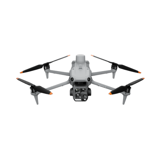
A thermal camera measures infrared radiation emitted from surfaces and converts it to a temperature map. From a drone, this allows us to capture temperature data across a large asset footprint in a single flight - identifying components or panels operating outside their normal thermal signature. The result is a georeferenced dataset showing temperature differential across the full site, with anomalies identifiable at individual component level.
Thermal imaging detects heat - specifically, temperature differential between components or surfaces. On a solar array, it identifies hotspots, bypass diode failures, string anomalies, and PID-affected modules that are invisible in standard RGB imagery. On industrial electrical infrastructure, it identifies resistance-related heating in connections, terminations, and components operating outside their normal thermal envelope. RGB capture records what an asset looks like. Thermal capture records how it is performing thermally.
Thermal imaging does not see through surfaces, detect structural defects, or identify material composition. It detects temperature differential - when surfaces are at uniform temperature, there is nothing for thermal to differentiate. It also requires appropriate operating conditions: solar arrays need minimum irradiance of 600W/m2 for reliable anomaly detection, and electrical infrastructure needs to be under representative load. Thermal data identifies and classifies anomalies. Root cause determination and engineering assessment are the responsibility of qualified professionals on the ground.
Every image captured by our platform is GPS-tagged at the point of capture via laser rangefinder and RTK positioning. When processed into an orthomosaic, every pixel has a known real-world coordinate. An anomaly identified in the thermal dataset can be located on a map to within a metre or two of its actual position. For your maintenance team, this means navigating directly to a specific panel or component rather than conducting a secondary search across a large site.
For most assets - solar arrays, rooftop systems, flat industrial roofs, construction sites at early stages - a 2D georeferenced orthomosaic is the right output. It gives your team a scaled, GPS-accurate top-down map they can navigate from directly. A 3D point cloud and surface model is the right choice when the asset has significant vertical complexity - industrial processing facilities, multi-level commercial buildings, substations, or construction sites where volume calculations and structural reference are needed. For these assets, thermal data mapped onto a 3D model means your maintenance team can navigate to a hot pipe joint or failing cabinet in 3D space, not just locate it on a flat map. If you are unsure which output suits your asset, contact us and we will advise before quoting.
A one-off capture produces a snapshot of current asset condition. It has immediate value as a condition record, warranty evidence document, and maintenance planning input. A scheduled program adds the comparative dimension - subsequent captures are measured against the baseline, new anomalies are immediately visible, known anomalies are tracked for progression, and repaired faults are confirmed as resolved. A one-off capture doesn't automatically become the start of that ongoing record - if you want comparison over time, that only happens once a Monitoring Program is in place.
A structured PDF report - covering flight date, conditions, sensor specifications, methodology, and anomaly summary, with GPS coordinates and imagery for each finding. This is the standard deliverable for every visit, whether a one-off capture or part of a Monitoring Program. Raw and processed files - GeoTIFF, KMZ, and CSV anomaly exports - aren't included by default, but are available on request for either engagement type.
PDF for the structured report - that's what's included as standard. If your team needs the underlying GeoTIFF, KMZ, or CSV files to work with in your own GIS or asset management platform, these are available on request, for either a one-off capture or a Monitoring Program. Advise us before the flight and we'll confirm formats and compatibility.
You own everything captured on your site. The PDF report is yours to use for your own maintenance, insurance, warranty, and reporting purposes - hand it to your electrician, O&M team, insurer, or lender the same day. If you've also requested the underlying raw or processed files, those are yours too, delivered in full.
Delivery timeframe is confirmed at booking - every job is scoped individually and we will not commit to a blanket timeline that may not reflect your site. For time-sensitive situations such as active warranty claims, regulatory inquiries, or urgent maintenance planning, contact us before the flight and we will discuss what is achievable.
Yes - this is a core function of a scheduled monitoring program. Captures are conducted using consistent flight parameters and the georeferenced outputs align spatially, allowing direct comparison between datasets. New anomalies are identifiable against the baseline, known anomalies can be tracked for progression, and repaired faults confirmed as resolved.
Both. All asset types - commercial rooftop solar, solar farms, industrial facilities, and construction - can be booked as either a single visit or a scheduled program. As a general guide, a single visit often suits a first thermal capture, a construction milestone, or a rooftop solar array, while solar farms and industrial facilities usually get more value from a scheduled program, since aerial data compounds in value when you have a baseline to compare against. We will advise which approach suits your asset after understanding the site.
We operate across South East Queensland and Northern New South Wales. For sites outside this area, contact us and we will advise on feasibility.
No. All data capture is conducted from the air. Standard ground-level site access for take-off and landing is all that is required. We do not need elevated access, scaffolding, or entry to restricted areas of the facility during the capture phase.
It depends on the size and complexity of the asset. A commercial rooftop array is typically completed in a single visit. A utility-scale solar farm may require multiple flights across one or two days. We will provide a time estimate as part of the quoting process once we understand the site.
For thermal capture on solar arrays, minimum irradiance of 600W/m2 and low wind conditions are required. For RGB capture, good visibility and manageable wind. We monitor conditions in the days before a scheduled visit and will contact you if rescheduling is required. We do not fly in conditions that would compromise data quality.
Yes. Our chief pilot holds a CASA Remote Pilot Licence covering sub-25kg multi-rotor and fixed wing platforms, a CAA Commercial Pilot Licence, and a CASA Remote Operator Certificate. All flights are conducted in compliance with CASA regulations and logged for audit purposes.
Not in the structural or electrical engineering sense, no. Our chief pilot is an ITC Level 1 Certified Thermographer and does assess and classify thermal anomalies as part of every dataset - that's a genuine part of what you're paying for. What we don't do is certify, assess, or sign off on the structural integrity, electrical condition, or compliance status of an asset. If you need a certified engineering or electrical report, you'd engage a qualified professional for that - our data gives them the evidence base to work from.
We carry public liability insurance covering commercial drone operations. Certificate of currency is available on request prior to site access. If your site has specific insurance requirements, advise us during the quoting process.
Yes. All operations are conducted under CASA regulations. Flight logs are maintained for every operation and are available for audit purposes. Airspace authorisations are obtained for any controlled airspace operations prior to flight.
Contact us through the website with details of your asset - type, size, location, and what you need from the data. We do not quote until we understand the site. Most quotes are turned around within 48 hours of receiving site details.
Asset type and size, location, what you need the data for - maintenance planning, warranty documentation, investor reporting, or regulatory compliance - and your preferred timing. For solar assets, array size in MW and approximate panel count if known. For industrial facilities, site footprint and any access constraints.
An O&M provider maintains and repairs the asset. SkySpectra captures independent data about its condition. When the company that identifies a fault is also the company paid to fix it, there is a structural conflict of interest. Independent aerial and thermal data capture means the findings go directly to you - not to the party billing you for repairs. Many asset owners deliberately keep these two functions separate.
Yes. SkySpectra operates independently of your O&M provider. The data we deliver goes directly to you. How you use it within your existing maintenance framework is your decision. We have no commercial relationship with any maintenance or repair provider and no interest in directing work to any particular contractor.
Every industry, one standard
Utility-scale solar, a commercial rooftop array, or a single roof - captured to the same standard and read by the same certified thermographer. Tell us what you're working with and we'll come back to you with what the data shows, not a generic quote.
We don't quote until we understand the site. Use the chat in the corner, or see what's included below.
Brisbane, Queensland
South East Queensland & Northern New South Wales
SkySpectra provides aerial thermal and RGB data capture services, including thermographic assessment of thermal imagery by an ITC Level 1 Certified Thermographer. This assessment identifies and classifies thermal anomalies but is not a structural, electrical, or engineering assessment, and does not constitute certification of any asset. Any decision regarding remediation, repair, or compliance must be made by an appropriately qualified professional engaged by the client.